Escaping to Mt. Chokai can be an excellent way to get amongst nature
How many mountains in Japan besides Mt. Fuji and the Dewa Sanzan can you name? Japan is covered in mountains, up to 73% of the archipelago in fact, which means it is also full of millions of places to explore. Mt. Chokai on the border of Akita and Yamagata Prefectures is the perfect place for a getaway, and it also happens to have the highest precipitation of any mountain in Japan. Escaping to Mt. Chokai can be an excellent way to get amongst nature, and whether it’s skiing, snowboarding, hiking, nature photography, pristine lakes, silky waterfalls, gushing rivers or otherwise, Mt. Chokai, is sure to please.
The trails of Mt. Chokai
Quick Info
Cost
Free
Opening Hours
Climbing to the peak is possible during the late Spring to late Fall. Heavy snow makes the trails inaccessible from the winter till mid spring.
Average Duration
Climbing to the peak and back takes roughly 8-10 hours and should be considered a dedicated full day hike.
Address
Hakodate Hut and parking lot: 〒018-0153 Akita-ken, Nikaho-shi, 象潟町小滝鉾立1地内
Other tips
A rental car or private transportation is highly recommended to reach the parking lot and trailhead. See available rental car options here. The nearest city for lodging is Sakata City. You do not have to hike all the way to the peak to enjoy a great hike on Mt. Chokai. Around half-way up the mountain you will find the Chokai Lake, a great destination for a more casual hike. Reaching the peak is significantly more difficult, so it may not be suited for novice climbers. In addition to climbing the peak, Mt. Chokai is home to many other gems, such as back country snowboarding and skiing.
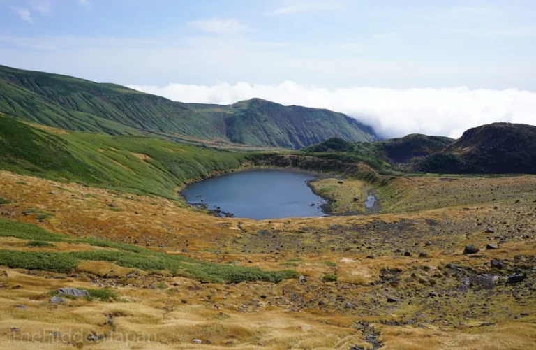
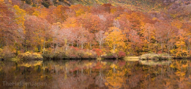
Mt. Chokai Lake
History and Geographical Information
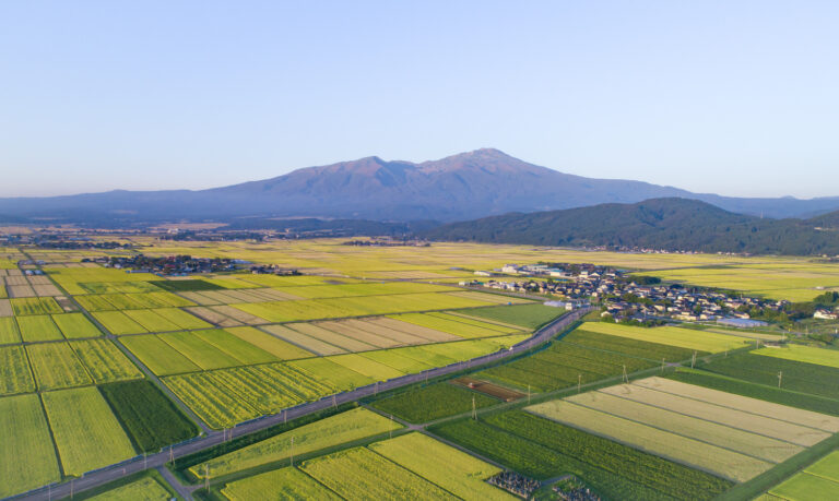
Mt. Chokai straddles the border of Akita and Yamagata Prefectures, but its peak is in Yuza Town on the Yamagata side. At 2,236m (7,336 ft.), Mt. Chokai is the tallest mountain entirely in the Tohoku region and is one of the only mountains in Japan that stands separated from other mountains. The mountain also falls directly into the sea, and is a popular location for swimming and hiking in the summer, including the Sea to Summit race, and skiing and snowboarding in the winter.
The mountain’s unique shape and location has given it a few nicknames, notably “The Fuji of Tohoku”, due to its resemblance to Japan’s most symbolic peak when viewed from the northern Akita Prefecture side, and “Dewa Fuji”, thanks to its location in the middle of the former Dewa Province. However, the shape of Mt. Chokai changes depending on the angle; when viewed from the Akita side to the north, it truly looks like Mt. Fuji, yet when viewed from Shonai plains to the south, its two distinct peaks really stand out.
One of the lakes on Mt. Chokai
The ecosystem on Mt. Chokai is also unique due to the highest precipitation of any mountain in Japan.
The water from Mt. Chokai feeds into the rivers and streams for the surrounding agriculture and marine industries that provide some of the freshest food in the land, while also offering a myriad of places to discover and enjoy.
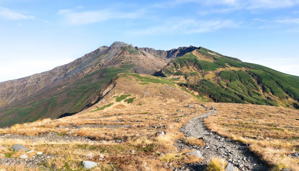
Hiking Mt. Chokai
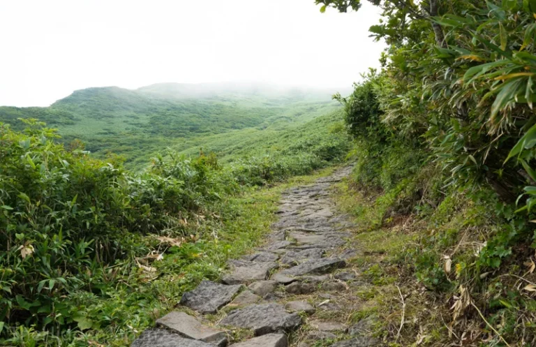
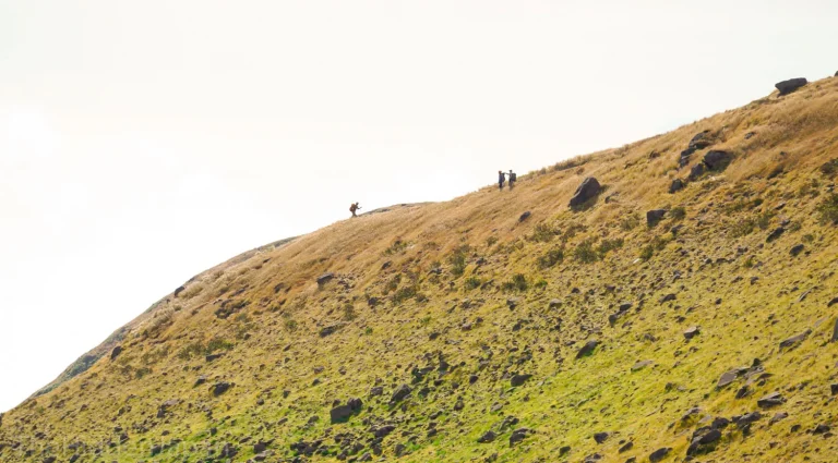
The beautiful grassy trails on Mt. Chokai
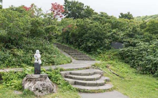
Mt. Chokai has been the location of pilgrimages for centuries. In fact, Mt. Chokai used to be one of the Dewa Sanzan, the three mountains of Dewa, which are worshipped by followers of an ancient Japanese mountain religion still being practiced today called Haguro Shugendo. Pilgrim lodges can still be found at the base of Mt. Chokai in Warabioka, however the mountain is rarely used for Shugendo training these days.
It’s thanks to this ancient religion that there are multiple trailheads to take up Mt. Chokai; Kisakata, Fukura, Nagasaka, Mansuke, Ni-no-taki, Yunodai, Momoyake, Sarukura, and Yashima for a total of nine. Below we will introduce the two most common routes, using the Kisakata and Fukura trailheads from the west, however the Yunodai trailhead from the southern side is also popular.
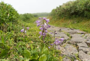
Some of the many wildflowers that bloom along the trail in Spring.
From the fresh flowers, some of which only grow there, and the snow of the Spring, to the deep green colors of Summer and fiery colors of the Fall; Mt. Chokai’s landscapes impress year-round, no wonder it’s a premier outdoor adventure location in Yamagata.
The ecosystem on Mt. Chokai is also unique due to the highest precipitation of any mountain in Japan.
The water from Mt. Chokai feeds into the rivers and streams for the surrounding agriculture and marine industries that provide some of the freshest food in the land, while also offering a myriad of places to discover and enjoy.
Kisakata and Fukura Trailheads
Mt. Chokai is semi-active volcano that last erupted in the 1970s, but is safe for exploring. Hiking Mt. Chokai is possible from April to October when the Blue Line (a 34km stretch of road that runs the length of Mt. Chokai from Yuza Town in the Shonai region, to Nikaho on the Akita side) is open, but the region is known for heavy snowfall so the warmer months from July to September are much more popular.
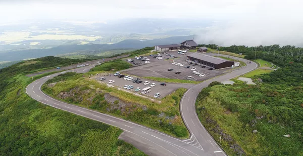
The Kisakata trailhead is the main Mt. Chokai route that begins near the Hokodate Hut and can be reached from the Blue Line. The Hokodate Hut is already 1100m above sea level, alleviating a considerable amount of the climb. The Odaira trailhead is located near the Odaira Sanso (mountain inn) a little further down The Blue Line. Take the Odaira trailhead if you wish to pass the crater lake on the way up.
The Hokodate Hut and its facilities
We recommend starting your hike from the Hokodate Hut as it has many facilities that can help prepare you for your long hike ahead. Here there are bathrooms, a guide center, bathrooms, a small restaurant, and even a lodging facility.
The start of the trail is located right next to the parking lot, and the beginning of the trail is paved with stairs but becomes rougher as you descend higher. We recommend hiking boots and a generous supply of water and snacks for those planning on going all the way up to the peak.
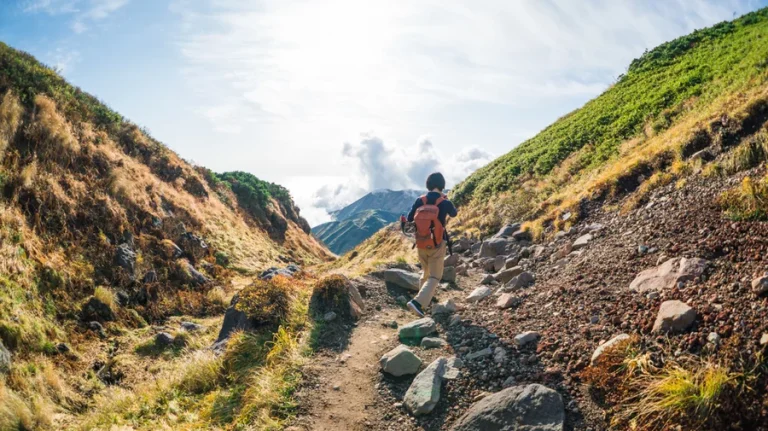
The Kisakata Trialhead
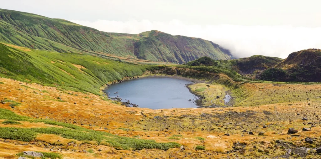
Chokai Lake
The lake of Mt. Chokai
Mt. Chokai has many excellent spots with sweeping views over the Shonai plains and the Sea of Japan. The first major landmark you will come across on your way up is Chokai Lake, a beautiful lake located at the bottom of one of the large craters on the higher parts of the mountain.
This is a perfect spot to stop for snacks along the crater, or to hike down to the lake itself to get a closer look. There is also a bathroom and small restaurant located here, the only ones on the hiking trails. Note however, that there are no trashcans here since everything at this point is airlifted to and from this spot via helicopter.
To those wishing for a casual hike, we recommend at least hiking up to this point to enjoy the beautiful view. Many of the elderly hikers and families with children turn around at this point for an easy-going half-day outdoor experience.
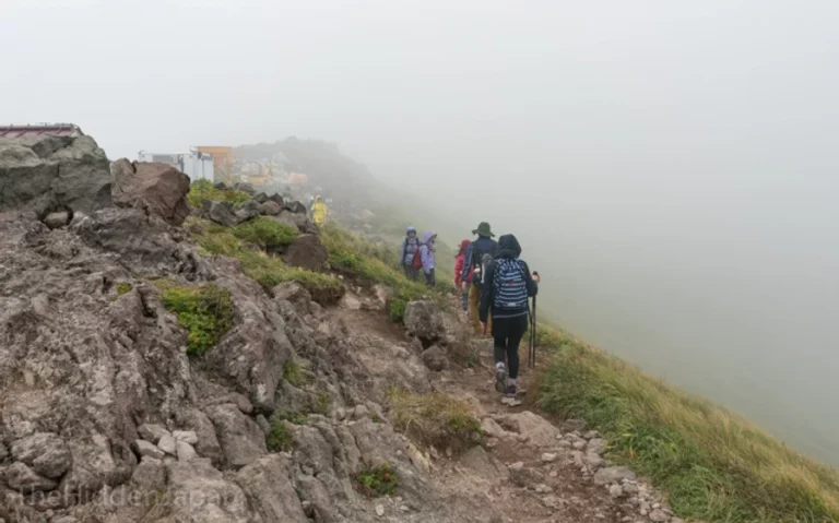
Some of the cloud cover at Chokai Lake
The crater is also a great point to turn around if the mountain becomes enveloped in cloud cover. Past this point, the trail becomes much rougher and can become a challenging experience with low visibility. However, it is still possible to climb it with the clouds and you may even emerge above the clouds near the peak.
Hiking to the Summit
To those proceeding to the peak, note that there are two paths once you reach Chokai Lake. Both lead to the same trail eventually, but taking the route to the left is considered easier and will take you across a glacier that never melts. The path to the right winds through a grassy valley which is also very beautiful, but takes slightly longer.
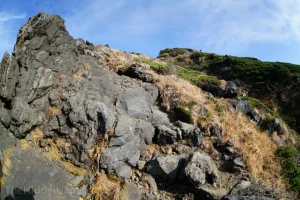
Once you clear the glacier or grassy plains, you will come to the last and most difficult part of the hike. From here on you will often need to use all fours to climb on the rocky trail. If it has rained recently, mud may also be a problem for those not wearing boots.
At the very last part of the ascent there are rocky outcrops which you also must climb up. Be sure to leave plenty of time to descend before sunset once you proceed past this point.
Believe us when we say however that climbing to the peak is worth the long hike. The tallest peak of Tohoku will not disappoint you.
But we will stop our explanation here and let you discover this for yourselves.
Some of the rocky terrain near the peak.
Accommodation
If necessary, both the Odaira Sanso and the Hokodate Sanso Hut are available for accommodation, meaning you don’t have to worry about getting up so early to get up the mountain. The two locations also offer very different accommodation options. The Odaira Sanso is more like a traditional Japanese inn and includes dinner, breakfast, and a hot spring. Prices vary depending on the food you choose, ranging from ¥6,800 to ¥9,000 per night. It costs ¥420 for the bath alone, and Onigiri rice balls for lunch are also on offer at ¥370.
The Hokodate Hut is more for those who simply want a place to sleep. One stay costs ¥1,800, with extra fees charged for bedding (¥50 for a blanket, ¥510 for a futon), gas (¥100 an hour), and showers (¥200 for 5 minutes). Staying the night before at the Hokodate Hut is a popular option for those using public transport. Be aware that water is not available from the hut, so you will need to bring your own. It can be very expensive to buy water on the mountain (up to ¥500 a bottle).
There is also an onsen hotel located right at the base of Mt. Chokai on the coast called Yurari. This hotel actively seeks to welcome tourists and has said they are happy to pick up visitors from the station and to help with transportation to the trailhead.
Other sightseeing spots in the Mt. Chokai geo park
The sheer size of Mt. Chokai has profound effects on its surrounding area.
The melting snow off Mt. Chokai feeds a vast network of underwater springs that give life to expansive forests, wetlands, and towering waterfalls across the area known as the Mt. Chokai Geopark.
This includes the incredible trail of Nakajimadai.
The up road takes you from the Shonai coast, through deep forests up windy roads to a wonderful view of Tobishima Island, or sometimes even Sado Island in Niigata Prefecture.
This is also a very popular spot for some night-time photography, as the atmosphere is clear and the starry sky a sight to behold.
Here is the address of the Hokodate Hut and parking lot: 〒018-0153 Akita-ken, Nikaho-shi, 象潟町小滝鉾立1地内